Before starting the hike, we took a quick jaunt to see Ollantaytambo’s fortress temple.
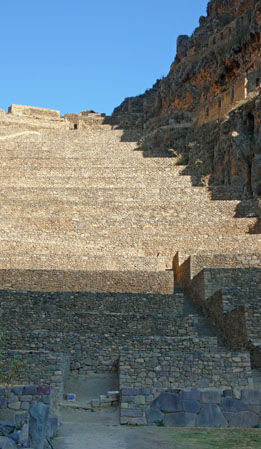
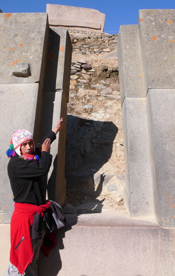
Day 1: Piskakuchu to Wayllabamba
Distance: 6.8 miles / 11 kilometers
Starting Elevation: 8600′ / 2621m
Ending Elevation: 9700′ / 2956m
Total Climb: 2,944′ / 897m
(I had an altimeter with me, so I could measure the elevation. It tends to measure high, so take all numbers with a grain of salt. I did not have anything to measure distance, and most estimates on the trail are given in time, rather than distances, for some reason.)
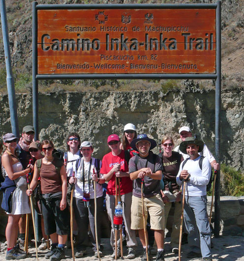
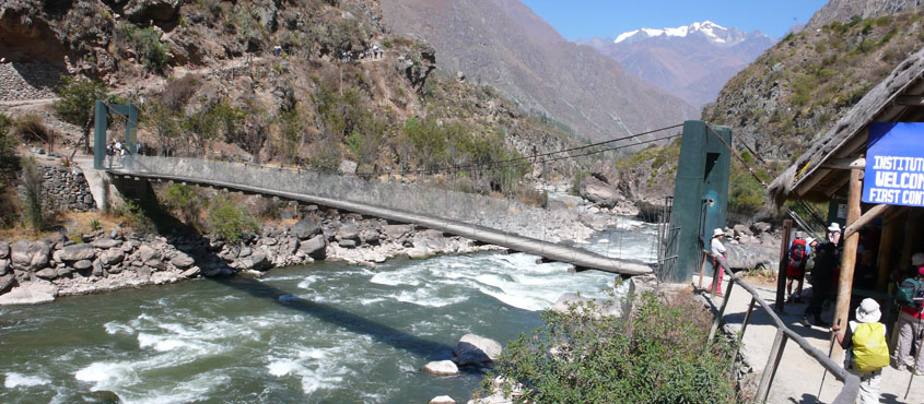
We crossed through the control office (got our passports stamped), across a suspension bridge that spans the Urubamba River, and started walking.
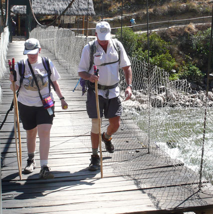
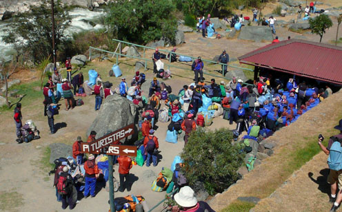
It was fairly easy, although the uphills went slow. We had to keep an eye back for the porters — they went much faster then us, even though they were weighed down heavily and had to get to lunch and camp to set things up for us.
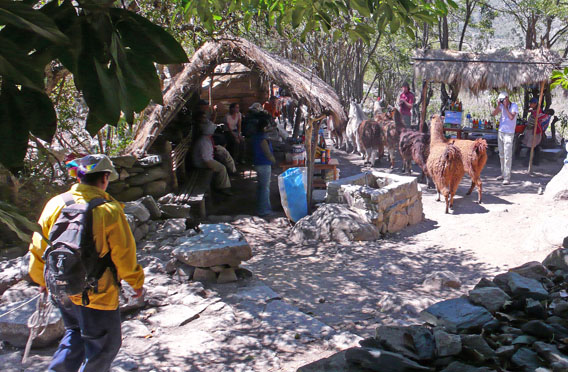
We passed through a couple of villages where food and drink were sold. We rested here, as did most of the hikers. It was very crowded. As Patricia said, “You think you are getting a wilderness experience, but you are really on a super highway.” But usually when I was walking I didn’t feel over-crowded. Just the rest stops.
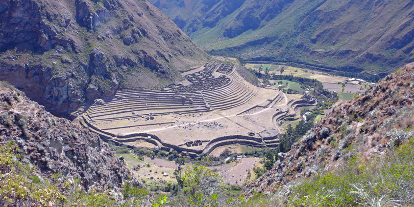
I lost the rest of my pictures from the trail! (It’s a long story.) The rest of the Inca Trail is just my notes.
Lunch was delicious, and unexpectedly comfortable in a tent with a table and chairs.
We reached our camp on the side of an uphill. The porters had set up our tents and inflated our mattresses.
Dinner was excellent. By 8:00, it was very dark out (the stars were spectacular — no moon at this point), and we headed to our tents to sleep.
Day 2: Wayllabamba to Paqaymayo
The Hard Day
Distance: ?
Starting Elevation: 9,700′ / 2956m
Ending Elevation: 11,503′ / 3,506m
Total Climb: 4,153′ / 1266m
Highest Point: 13,442 /4,100m
This was the day we went over “Dead Woman’s Pass” (supposedly named because the mountain looks like a woman lying down. I don’t know why they didn’t name it “Sleeping Woman’s Pass.)
We started hiking. I was very, very slow, but didn’t need to stop as much as the faster hikers. It was very hard going at the end, though. The path was steep steps, and the elevation was obviously having an effect. But we all made it, and got the beautiful views and our picture taken. Then we headed down to our camp.
Once again, dinner was excellent, and we got to bed by 8:00 or 8:30. It was much colder in this camp.
Day 3: Paqaymayo to Winaywayna
The Long Day
Starting Elevation: 11,503′ / 3,506m
Ending Elevation: 8,780′ / 2,676m
Total Climb: 2,378′ / 723m
Total Descent: 5,061’/ 1,543m (!)
We went down a long way down today! We started going over a small pass (Runkuraqay Pass), then went either flat or down. When we crossed the pass, the climate changed, and we walked through a cloud forest. It was lovely — I’m really looking forward to the Manu trip, where we will spend the night in a cloud forest.
Visited some ruins.
When the down started after lunch, it was mostly steep steps. I got very nervous of the crowds of people going down together — I didn’t want to trip and fall and take a bunch down, or have the same thing happen above me and have us all end up in heap. So I sped up, and hurried through them. I kept up my fast pace all the way down to the Travellers’ Camp. In retrospect, I think that was stupid and dangerous, but I survived.
My guide book describes the camp as “a monstrous wart on the virgin forest” but I must confess, I was very happy to have a shower in the lukewarm water and grab an over-priced beer. The trail was very dusty. Sheila was happy for the sit-down toilets. Most of the group had a good time hanging out inside and chatting.
But it is an ugly, crowded campsite. I got lost several times going from the toilet back to camp. Fortunately, we were far from the bar — I can just imagine the noise at night.
Day 4: Winaywayna to Machu Picchu
Gateway to the Sun & Machu Picchu
This was the day we had been waiting for! We got up at 4:30, had a cold breakfast, and were hiking the trail by 5:30 in the dark along with every other group in camp. The walk was pretty easy until the end, when we went up some VERY steep stairs, and then hiked another ten minutes to the Gateway to the Sun, which supposedly has the best views of Machu Picchu.
We wouldn’t know — the clouds completely obscured the scene below. Occasionally there was some clearing, but never for long. Oh well.
While there, I noticed many people on their cell phone. My first thought was, “How tacky!” However, soon word filtered through about the terrible earthquake in coastal Peru. We had felt nothing, and indeed, in my entire trip, I never saw any evidence of the tragedy.
We walked down the Machu Picchu (about 45 minutes) and explored the archeological site. (Jeremy told us not to call them “ruins.”)
Once advantage of hiking the trail is that the first trainload of tourists from Cusco doesn’t arrive until about 10:30 am, so it’s not as crowded in the morning.
When we were done, we took the bus down to Agua Calientes, had a dinner (which included alpaca and guinea pig), sent email or called home saying, “we’re fine,” and explored town. Patricia soaked in the hot springs, Sheila and Moira bought shirts reading “I Survived the Inca Trail,” Jo and Bella got pedicures, and many people got massages.
Although I had felt strong and healthy through the entire hike (except for breathing at altitude, of course), almost as soon as I reached Machu Picchu, I started to crash. My energy level dropped all day, and my stomach started to give me problems. So I did very little in town except send a quick email, and wait for our departure.
We caught the 8 PM train, transferred to a bus some where along the way, and reached Cusco at midnight. By the time everything was sorted out and I climbed into bed, it was 1 AM. A very long, exciting, day.